Many orienteering maps are initially derived from copyright Ordnance Survey material, and it is currently a condition of our use of such materials, on which we pay licence fees to the OS, that our maps or extracts from them are usually not published on web sites.
It is worthwhile stating here that possession of any orienteering map does not give right of access to an area - permission must be obtained from the landowner. Furthermore, illegal photocopying of orienteering maps could leave the user in trouble with both the orienteering club and the Ordnance Survey.
Forested areas of what was originally Dorset heathland suffer from the giant furrows created when the area was first planted and have given the Furrow Hoppers relay its title. Environmental concerns (principally the protection of ground nesting birds such as the Dartford Warbler and Nightjar) mean that we are unable to use many of our forested or heathland areas between February and July/August, so our summer events tend to use parkland or urban areas (see below)
Avon Heath Country Park - 1:7 500 John Warren 2011,revised 2020 Originally mapped in 1983 when it was known as Avon Forest Park and used until 1987. Has now been reverted to Dorset Heathland with the removal of most of the coniferous woodlands. Now available again for orienteering after a gap of over 20 years. A permanent orienteering coursewas developed for use from 2016, but parts of it are out of action during the groun-nesting bird season.
Avon Water, Brownhills & Set Thorns 1:10 000 John Warren 2008, incorporating older surveys by the late Mike Tween, John Warren, Colin Hicks & Rod Postlethwaite. Also called Wilverley on some maps. Copyright held jointly by WIM and SOC
Typical New Forest area. Used for badge events and larger colour coded events.Difficult to find suitable parking these days as the FC campsites we used to use off season now remain open during the winter. Last used by WIM for a Regional event in 2017.
Badbury Rings 1:7 500 John Warren 2013, extended by Chris Branford 2015 Open grassland plus wooded areas surrounding the hill-fort of Badbury Rings, near Wimborne. Owned by the National Trust and adjoins the Kingston Lacy estate. Used for small scale events and some MTBO since 2014.
Bryanston School, Blandford Forum 1: 10 000 originally John Warren 1994, survey JW, Dick Keighley and WIM members. Updated by Chris Branford in 2009
Mixed woodland, open fields and school campus on with steep slopes on W. side of River Stour. Available only in school holidays. Used for WIM Gallopens in 1995 and 2002, also for ‘97 Boxing Day Canter, Furrow Hoppers relay 2009 & 2004 and various smaller scale events. a long, thin area which suits score events. Access has been restricted lately.
Blandford Camp, Blandford original 1:10 000 John Warren 1996 revised 2000, and again in 2006. Produced for Royal Signals OC. Resurveyed & redrawn in ISSOM Sprint format by Steve Mallison Summer 2011
Largely open with small patches of woodland : many buildings. (The Signals allow us to use the area occasionally - access sometimes difficult. ) Used for a Furrow Hoppers relay in 2006 & 2011, midweek event summer 2015.
Bovington Ranges 1:15 000 and 1:10 000 updated John Warren Spring 1999 & 2005 from original Dudley Budden map (‘94) and again by David Bland in 2006
In many ways our best area. A complex mixture of army training areas and woodland was used for the 1999 Caddihoe Chase in September ‘99, Day 1 of which was a National Event. Used for the WIM Gallopen in Oct 2000 and again in Oct 2001. Used for a Regional event in February 2005 and for the Caddihoe Chase in September 2006. The northern half of the map is also used separately under the name Chamberlaynes Heath. Access to Bovington is becoming increasingly difficult under recent army administrative changes.
Canford School, & Merley 1: 5 000 John Warren, July 1996 with later revisions up to 2016
School campus, playing fields and woodland. Made for the school in 1996, used by the club for small scale events and often for the annual BBQ event, now generally incorporating the urban area of Merley by Chris Branford
Clayesmore School & Iwerne Minster Clayesmore School surveyed 1: 5 000 John Warren 1996 Complete resurvey to ISSOM at 1:4 000 by Dick Keighley in 2007, with the addition in 2010 of the village of Iwerne Minster
Largely open area with some woodland. Staged Furrow Hoppers Relay in 2013. Redrawn & ge-referenced by Chris Branford 2021, survey Dick Keighley, Rob Mills, Chris Branford
Cranes Moor 1:10 000 Chris Branford and David Bland 2007, updated 2010,2011-12
An area adjoining the S & W sides of the main Bovington map and incorporating a small part of that map. Forest and army training areas surrounding the Bovington camp residential areas, first used for the British Schools Championships in Nov 2007, since used for a Regional event in 2010 and again in 2012.
Ferndown Forest, Ferndown 1: 10 000 Dale Paget 1990 based on John Shucksmith’s 1982 map with resurvey by BS, RW & DK.
Largely coniferous plantation, now in need of updating following felling and replanting. Used for various colour coded events and relays but 'rested' over the last twelve years. Currently (2022) beung resurveyed.
Godshill, Turf Hill & Millersford, New Forest 1:10 000 John Warren Autumn 1997, updated for Regional event in 2006 & for Galoppens in 2011 & 2013, and for Winter Warmer Regional in 2016 & Godshill was used for the 2016 Galoppen round.
Two overlapping A4 sized maps covering a long thin area of coniferous plantation and deciduous woodland linked by open heath. The adjoining area of Hale Pulieu was mapped by John Warren in 2012 and added to the Turf Hill map for the 2013 Regional event. An updated map was used for Day 1 of the 2021 Caddihoe when it was also the SW Middle Championships and a UKOL event.
Golden Cap Morcomebelake, W Dorset 1:7 500 Mike Kite 2014 rev 2021 The first WIM map to use Lidar data. Well contoured mixture of runnable forest and open grassland, first used for a schools/informal event in 2104. linked to the Stonebarrow map for a Regional event in 2021.
Gore Heath Wareham 1: 10 000 John Warren 2004 revised Chris Branford 2007/9
A small but excellent area used for a regional event in Jan 2004.and for the WIM Galoppen in October 2004, then for a British Schools selection race in 2007, the inaugural SW Middle Distance Championships in 2009 and the JIRCS individual day and the Southern Night Champs in 2013. Extensive heavy felling and windblow in the Feb 2014 storms and a change of land ownership have made it unavailable recently, but there are hopes it may be back in use in late 2022.
Hordle Walhampton School, Lymington 1: 5 000 John Warren 1999
An area of woodland, lakes and playing fields on the edge of the New Forest. Produced mainly for internal school use but christened at the Furrow Hoppers relay in July ‘99 and used again in July '01.
Hurn Forest North 1: 10 000 - John Warren, incorporating survey by Brian Sutton & Ron Wilton 1997, updated 2003 and again in 2009 & 2013
A small area of coniferous forest, used for annual schools and informal events. Also used for MTBO events
Hyde & Gorley Commons 1:7 500 Chris Branford 2013 updated 2018 A small area of new Forest Heath and old gravel workings, used for club training and Dorset Schools events
Ibsley & Rockford 1: 15 000 & 1:10 000 Updated John Warren 2007. Original map Peter Child (‘86) and Mike Tween (‘89) from a pg plot. Used for a regional event in 2007, updated 2013
Open area of New Forest heathland. Well contoured, good technical area- used for Harvester in 1986. Used for an Army Championships in May '97and WIM Gallopens inï '97 and '99 as well as the Furrow Hoppers Relay in 1998. The area, formerly owned by Lord Normanton, is now owned by the National Trust. Parking and access were difficult for a time, but new sites have now been found.Used for a Regional in 2013, Gallopen in 2015.
Inside Park, Blandford Forum 1:10000 - John Warren, 1996, original survey JW + WIM members 1995, map updated JW 2002 & 2004, minor modifications RK 2006, Chris Branford 2008-9, redrawn CB 2018, updated 2020
A small area of mainly deciduous woodland surrounding a campsite first used for WIM’s 1996 Gallopen, the ‘98 Night Owl, a couple of Boxing Day Canters,and a Furrow Hoppers relay. Pleasant area, ideal for junior training. Used for a Night event and a schools event in Nov 2004 and again in Feb 2006. In 2009 & 2010 it hosted 3-events-in-a-day MTBO/Schools League/Night Owl, repeated in 2012. Left fallow until 2019 whilst forestry work took place. Used for SW League events in '2018, 2020,
Kingston Lacy, Wimborne 1: 7 500 John Warren 1995 resurveyed during 2000, updated 2014
Mainly open, some wooded areas. Produced in co-operation with the National Trust. Largely used for introducing school groups to orienteering. Was used for small informal events. Now used for small midweek evening events under the aegis of the National Trust.
Kingston Maurward 1:4 000 John Warren 2002, revised Di Tilsley 2009-10
Parkland, woodland and open farmland around Kingston Maurward Agricultural College near Dorchester. Used for small scale, informal events, Furrow Hoppers relay.
Milton Abbey 1:5 000 John Warren 1998
The school Campus and grounds plus a steep, well-featured formerly runnable woodland. Mainly for internal school use, but used with success for small informal events in August ‘99, 00 & '01. Increasingly overrun with brambles in some parts of the forest & currently being 'rested'..
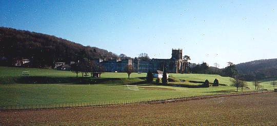
Milton Abbey - the forest is the wooded hill in the background to the left of the picture.
Moors Valley Country Park 1:10 000 - John Warren, originally May 1999 now updated annually as the Country Park expands its activities
Formerly known as Ringwood Forest South and incorporating the small area previously mapped as Jack’s Garden. A large coniferous plantation, available after a nine year gap in the '90's whilst the forest was redeveloped as a Country Park and as near to the club's 'headquarters' as O-clubs ever get. A permanent course has been constructed funded by grants from the National Lottery & East Dorset Council and is now in operation. (A permanent Trail-O course was also developed here with the aid of a grant from BOF but harvesting has made it unavailable) and an MTBO course is also now available. Widely used for schools events, Boxing Day Canters and club training. Redrawn and georeferenced by CB, (survey JW & CB) for the 2021 Canter.
Port Regis 1:5 000 John Warren 2003, updated 2013,20216 Port Regis School, nr Shaftesbury. An area of playing fields, golf course, woodland, school campus, intermittently availble during school holidays. Used internally, for schools events and for the 2014 Furrow Hoppers relay
Ringwood Forest North 1:15 000 and 1:10 000 updated John Warren 2003 et seq. Used for a Regional event & Boxing Day Canter in 2014
Large area of very variable, largely coniferous forest. Formerly one of our best areas, but recent extensive felling means it is currently more suited to MTBO than FootO. Used for an army championships in ’97 and the WIM Badge events in ‘98 and 2000 and the Boxing Day Canter in Dec '00. Part of the Northern area was used for the relay at the 1999 junior inter-regionals in July.Also used for a round of the CompassSport Cup, the 2003 Furrow Hoppers relay and the 2003 Galoppen. There has been considerable "harvesting" of mature timber in the last few years and the very north of the area has now been lost to gravel extraction. Also used for MTBO events. There is a permanent MTBO course with maps available from Moors Valley.
Stonebarrow , near Charmouth 1:5 000 Mike Kite 2015 Clifftop area owned by the NT, First used 2015 again duirng 2016. The NT have established a permanent course there. The map can be downloaded via a link from the front page of the WIM website. The map was extended to link to the adjacent Golden Cap map for a Regional event in 2021.
Thorncombe Wood 1:4 000 Mike Kite 2019 A beautiful small technical,area of runnable deciduous wood and Dorset heath , the boyhood playground of the novelist Thomas Hardy, on an area full of interesting swallow holes and old workings, mapped with Lidar contours. The area is owned by Dorset Council and managed from a Visitor Centre near Thomas Hardy's Cottage (NT). There is a Permanent Orienteering course (POC) installed, map available by download from this website. Used for a small local event in Oct '19 and the first ever British TrailO League events in Feb 2020.
Washers Pit, Ashmore 1:10 000 original survey & cartography Map Works , Autumn 1998, Revised John Warren Autumn 2000. New edition Chris Branford 2009
A well-contoured area of mixed deciduous woodland and coniferous plantation, first used for WIM Badge event in Jan ‘99. Surprised many people by the technical and physical challenge it posed. First used for a Badge event in February 2001 and a Galoppen in Feb 2003. Used for a Galoppen in Nov 2009 & S. Night Championships under snow in Nov 2010.
Wootton Hill 1:5 000 Mike Kite 2011 Small area of largely runnable woodland near Charmouth. First used in 2012.
Urban Maps
With the developments of urban orienteering and sprint events, since 2009, Chris Branford has produced ISSOM maps of areas of Fordingbridge, Potterne Park and Verwood East, Wimborne, Blandford Forum, Poundbury in Dorchester, Gillingham, Merley (incorporating Canford School), of the large area Parkstone, Hillside & Broadstone Rec which is used for Community Orienteering. These areas tend to be used in the summer months when access to many of our main areas is not possible for environmental reasons, and for urban night orienteering during the winter months. There are also maps of Sturminster Newton (Dick Keighley 2014 rev 2021), Sherborne (2015) & Shaftesbury (made by Mike Hampson of OD in 2011) , Shillingstone (Dick Keighley 2015 rev2020) , Child Okeford (Dick Keighley 2021)and older maps, dating from the Foot & Mouth outbreak in 2001, by John Warren, of Ringwood, Wimborne & St Ives.
With the development of the MapRun app, which coincided with the onset of the Covid outbreaks in 2020 onwards, these urban areas have become much used for local MapRun traing courses and local MapRun league events. See MapRun section for more details
Other Areas (now largely unavailable)
Jack’s Garden A remnant from Peter Brett’s mapping days. Now added to the Moors Valley Country Park map. May well resurface as a small map for training events.
Hyde House, Wareham 1:5 000 - John Warren, 1994
An interesting area of Golf course and thick woodland astride the River Piddle and incorporating three lakes formed from old gravel workings. Used for the Furrow Hoppers relay in ‘95 & ‘97 and a couple of schools events. Formerly used as an Outdoor Education Centre, the area has now been sold to a new owner who has put up “Private” signs. Now lost to orienteering for the foreseeable future.
West Moors 1: 10 000 Peter Brett 1982
A small area of typical Dorset Forest, with giant furrows much in evidence. The last of Peter Brett’s many maps. Now much in need of up-dating. Used almost annually until 2002 for an informal event
Somerley Park 1:10 000 John Warren 2006
Part of the Somerley estate .Open parkland and mixed woodland. First use is set for a Local event in October 2006. A private estate and Golf course surrounded by extensive woodlands, unfortunately heavily infested with rhododendron. The central area is suitable for small events. The entire area, when added to the contiguous Ringwood forests, would make a splendid and challenging MTBO area. Access has become problematical again recently as sand and gravel extraction has progressed over the area..
Moreton 1:7 500 John Warren 2010 A small, privately owned area of open fields and mixed woodland. Used for schools league and informal events in 2011 & 2012. Only available on odd occasions